Callala Beach Is Not Collaroy

The most recent in a sequence of dreaded East Coast Lows to affect the NSW coastline during the first half of 2022 has teased out some interesting observations.
This early autumn storm moved slowly southwards from Queensland before heading off towards NZ, leaving a trail of havoc and damage to public infrastructure along open coastal beaches as amply reported in various popular media.
Callala Beach was of course exposed to the same weather system and sustained typical erosion from a storm of this magnitude and direction, including a bite of about 1 metre into the primary dune face and substantial movement of beach sand to where it is now presently situated directly off the beach.
Let’s compare these two situations:
- The reported damage to open coast beaches was principally to seawalls and promenades, that is man-made interventions built to resist the power of a rampant ocean and so protect the coastal interface. It is pretty clear from the attached photographs as to which won that battle. The sand is likely to have moved well away from these beaches, through being subjected to strong lateral forces that can move it to other places up or down the coast in such events. The broken infrastructure must be repaired or replaced, as it will need to be again in future events.
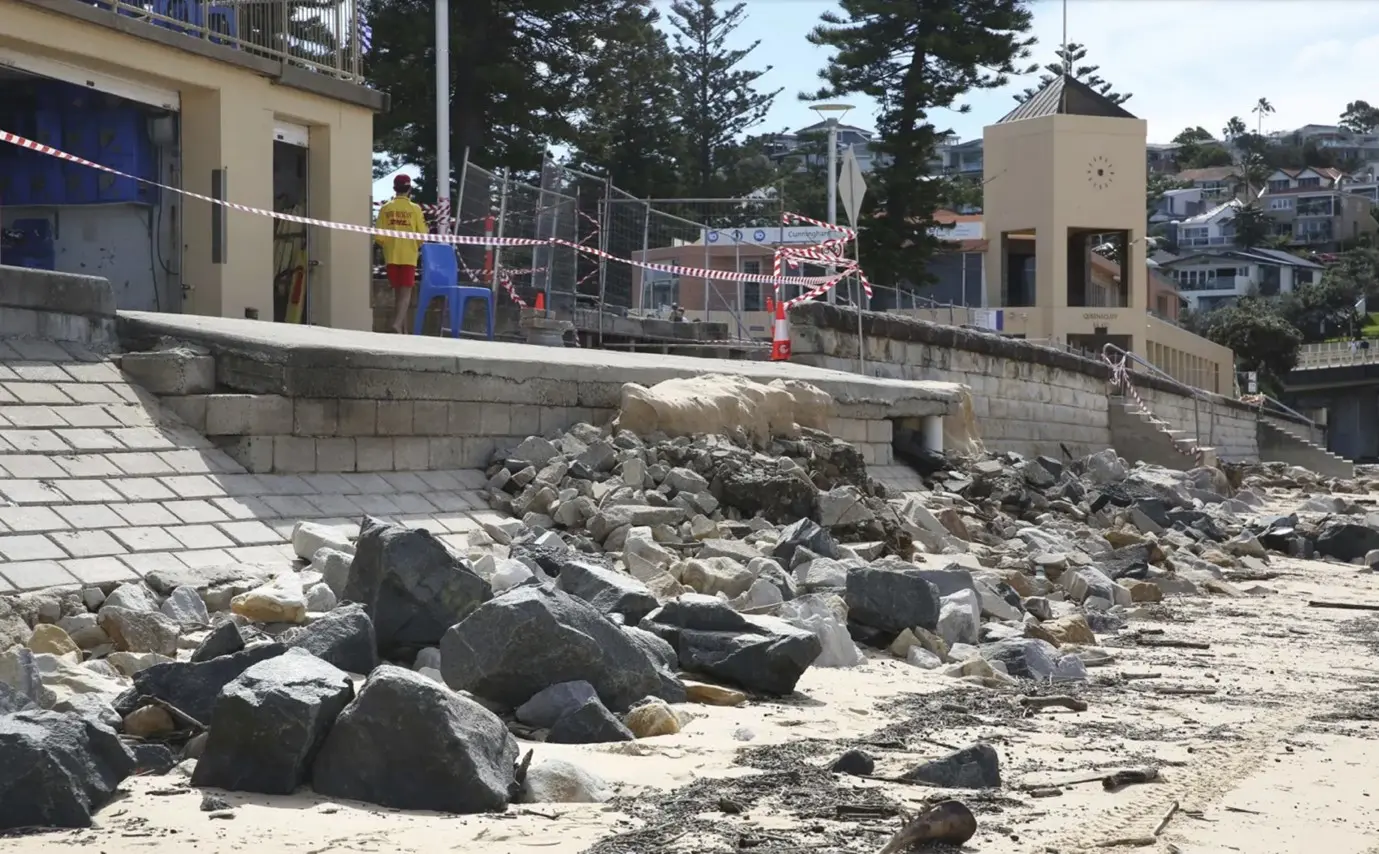
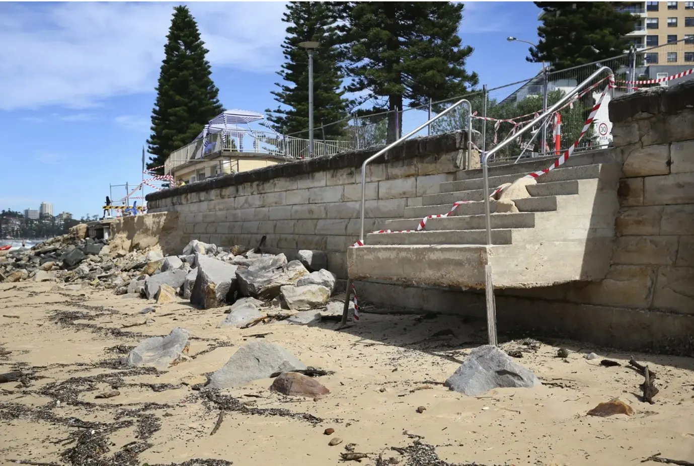
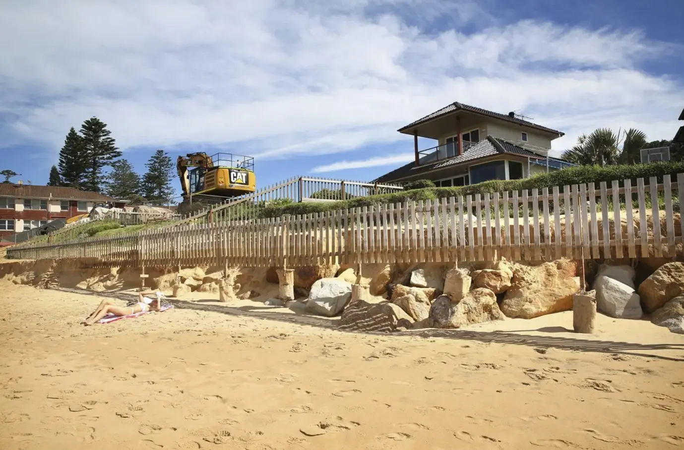
Exposed infrastructure at Queenscliff and Collaroy April 2022.
Unlikely to repair itself with absence of vegetated foredune (Source: SMH)
- The damage to Callala Beach, some 10km inside Jervis Bay was very different to this. We are blessed with a precious, natural coastal dune system that remains intact: the sand is now sitting just off the beach waiting to be gradually pushed back up by tides and wind. This system will steward the natural, capital-expenditure-free repair of the beach front over coming months.
Movement of the primary dune position over time is dynamic as a result of these forces. As discussed in a previous blog, Callala Beach has been a building beach due to its location inside Jervis Bay. Thankfully catastrophic dune damage such as occurred in the 1974 storms is very rare, however the natural beach repair process at Callala has claimed back 30 metres of the Bay since then.
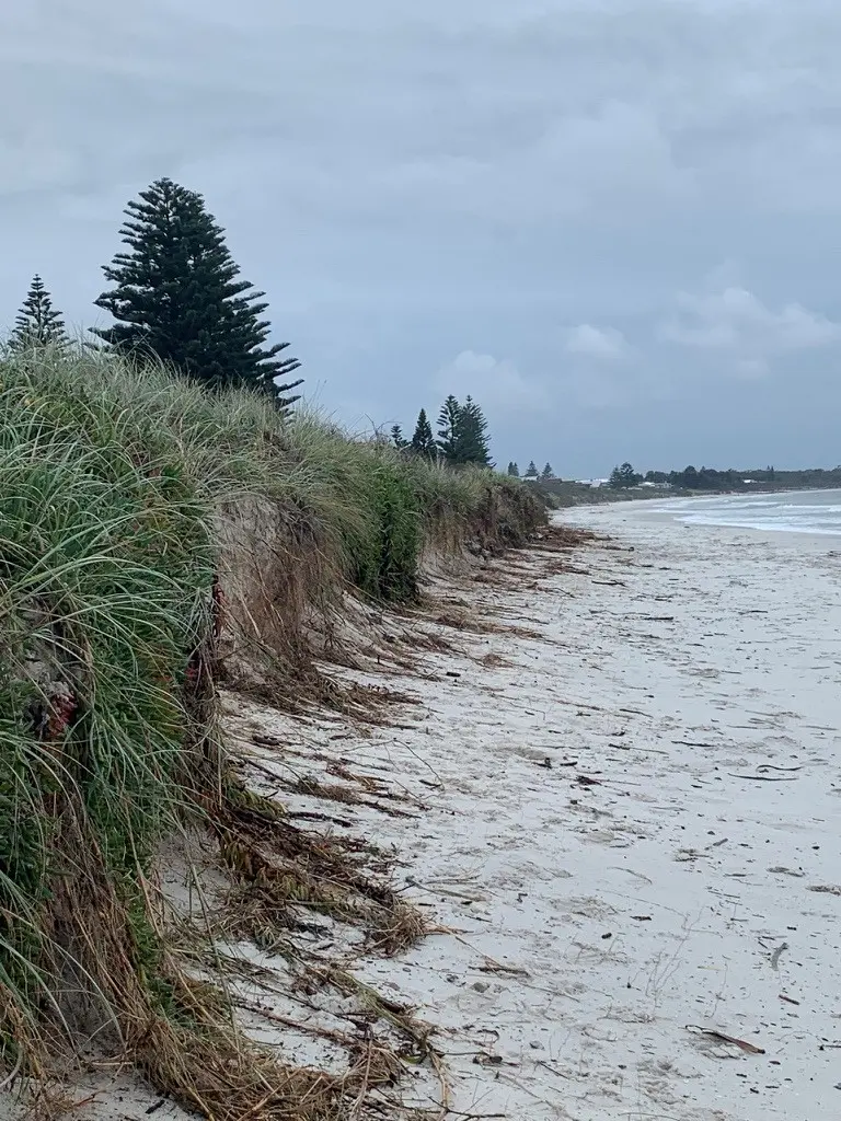
Callala Beach foreshore after East Coast Low of April 2022.
Foreshore damage is minimal where dune planting is dense and rapidly healing.
This is essential context for anyone interested in coastal processes, and should be fundamental to any planning body that has agency over coastal management. Unfortunately, Shoalhaven Council seems intent on planning the foreshores of the entire LGA coastline with a broad brush of dumbed down uniformity, if their proposed amendments to the LEP and DCP are anything to go by. The Department of Planning is a powerful but largely anonymous by-stander, apparently preferring simplistic, one-size-fits-all desktop-driven outcomes over a more tailored, real-world approach that would embrace the tremendous beauty and diversity of the forces that shape our coastline, rather than deny them.
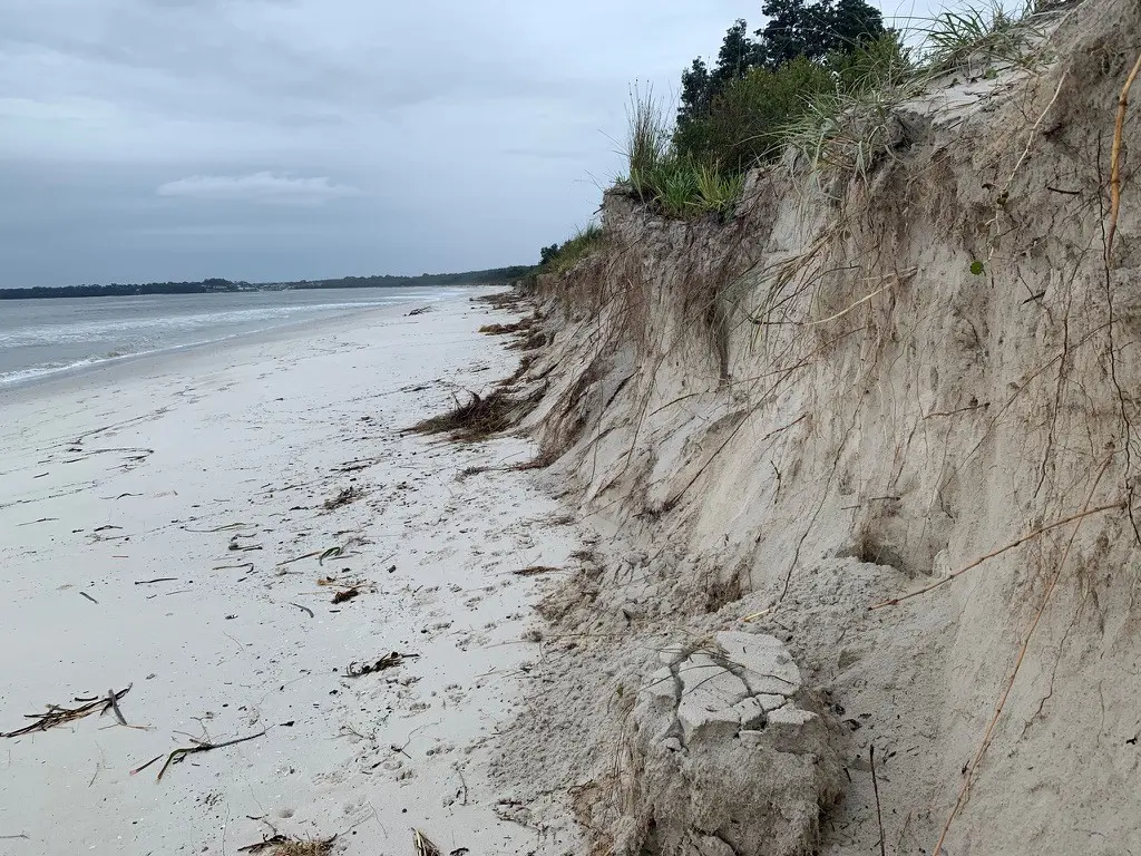
Callala Beach foreshore after East Coast Low of April 2022.
Foreshore damage is much greater at public accessways where there is a lack of dune planting to provide coverage.
The past is of course no guarantee of the future (if in doubt ask a financial planner). What needs to be pursued is research into ideas about how rising sea levels can be mitigated to ensure that Callala Beach remains the exceptional place that it is. Rising future sea levels mean that each storm starts from a higher baseline, and in combination with king tides and storm surge the future is indeed unknown territory. The CFA can play a significant role here, as an advocate for sustainable, necessary change.
Money can solve a raft of problems, but it is not likely residents or Council will be in a position to accept or fund exposed breakwater rock walls such as along the Botany Bay foreshore, or the massive revetment-style concrete ramparts recently constructed at Collaroy.
Fortunately we have a more predictable and natural environment in Jervis Bay that we need to work with to ensure a superior, more sustainable long-term outcome.