
The Shoalhaven is blessed with a magnificent coastline of headlands, beaches, bays, basins, creeks, rivers and lakes, set in a unique natural landscape that in many ways defines the essence of what the NSW South Coast is. Global warming has many consequences with one - sea level rise – being a key issue that should be at the fore of the CFA’s mission.
Unless arrested by a de-carbonised world, sea level rise will re-shape land/water interfaces across the globe, including our little 5.6km stretch of sand inside Jervis Bay. The threat is real over time, and the CFA is committed to understanding and mitigating its impacts.
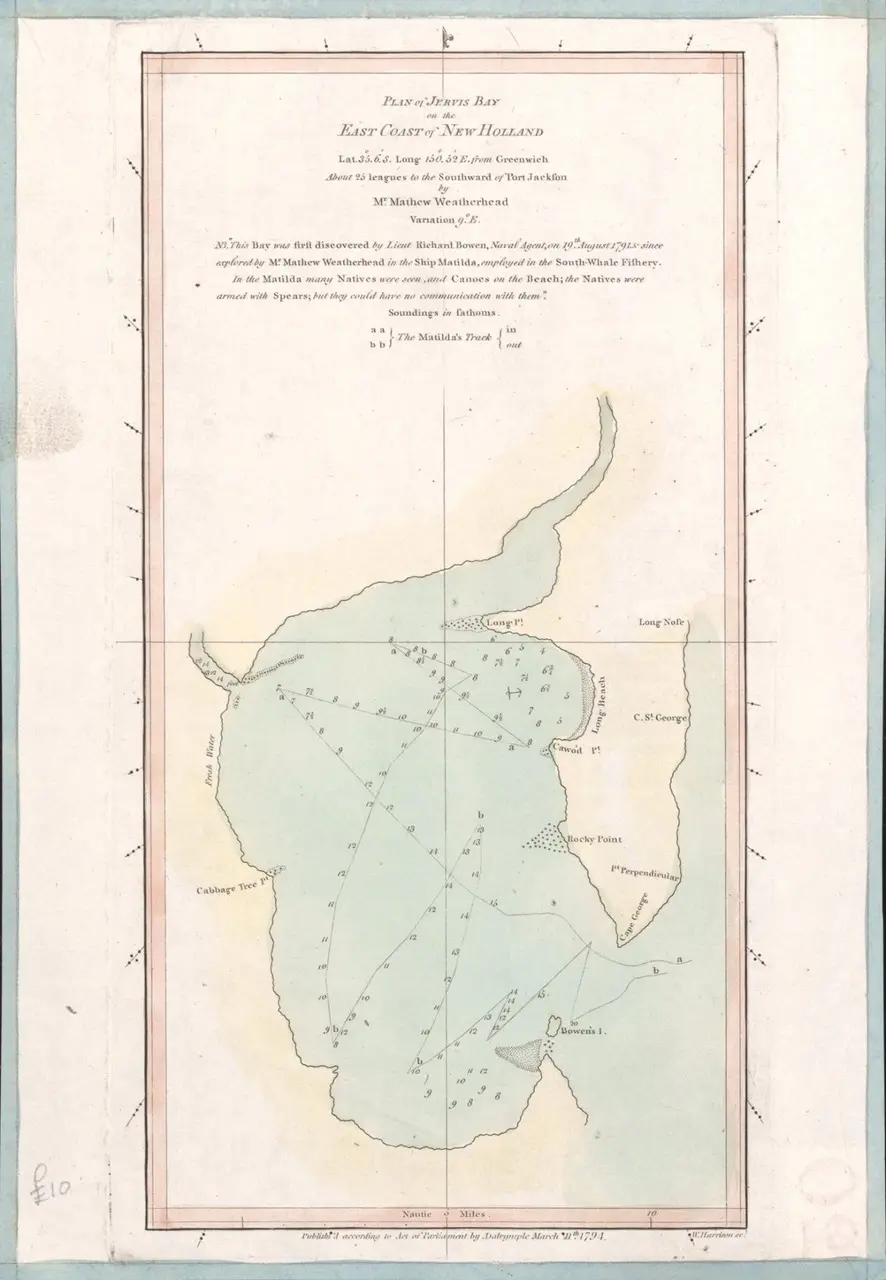
1796 Map Jervis Bay
What needs to be better understood by stakeholders – residents, Council, NSW Govt agencies - is that each place has unique circumstances that directly affect how sea level rise will impact upon it. For example, an open coastal beach is exposed to littoral (sideways) currents and drift that can transport huge volumes of sand along the coastline and sometimes in large storms, even around a headland where it becomes trapped in the next embayment – a recent example is loss of the beach sand at Byron Bay. A beach contained within a bay – such as Callala – is not exposed to the same forces however. When Callala Beach is subjected to large south-east swells the sand is sucked out off the beach and sits directly offshore until coastal processes (tides and wind) slowly but surely push it back onto the beachfront. Long term residents are entirely familiar with this natural rhythm and process.
Another interesting fact is that prior to subdivision and construction of the settlement, aerial survey photography clearly maps the village being built over what were dozens of perfectly parallel, concentric heath-covered dunes representing the inexorable, eastward movement of shoreline position over previous millennia. In other words, this indicates that historically the shoreline has advanced into the Bay, and not vice-versa. If more evidence is needed consider the relatively recent twin storm events of May 1974, considered by meteorologists afterwards to be a 1:1000 year occurrence. The very substantial dune bite line from these storms remains visible today, approximately 30 metres inland of the current primary dune face.
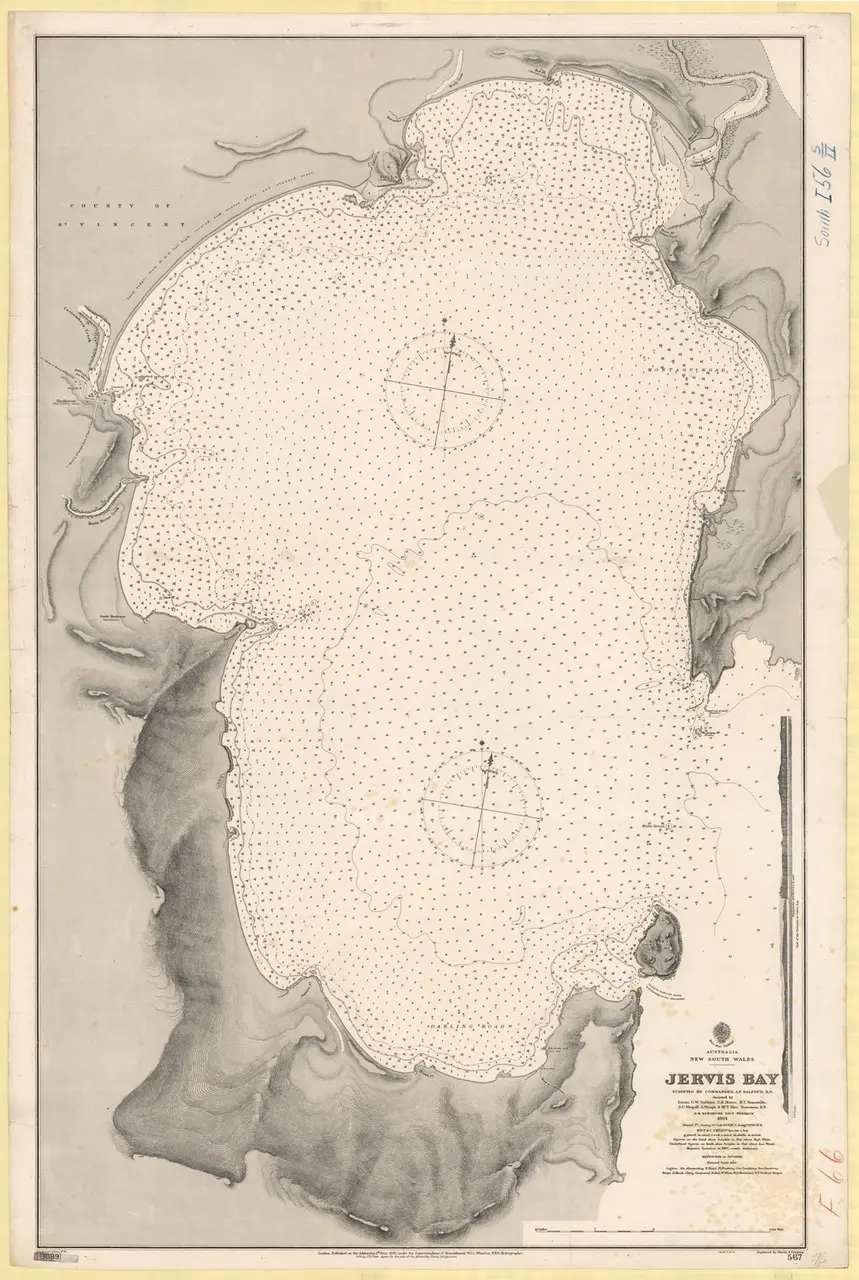
1894 map of Jervis Bay
This means that Callala Beach has historically been a “building beach”, not a receding beach. Why? Simply put, because our fine white sand is trapped in Jervis Bay, and like our dolphin community (another story), a very long-term resident with no foreseeable impetus or known plans of going anywhere!
So while sea-level rise will impact on Callala Beach, it is quite simply wrong to assume that its effects will be the same as elsewhere in the Shoalhaven.
Which brings us to the point of this discussion. Council’s recent public exhibition of PP026 – Coastal Hazards Review (Revised Approach) was prepared at the behest of the Dept of Planning. In a nutshell, it seeks to replace a reasonable working document (DCP 2014) with one that now designates entire swathes of coastal property up and down the coast as 100% subject to “beach erosion hazard”.
As background Council prepared a set of coastal hazard lines based on then current science over a decade ago, to ensure that new coastal development would be reasonably protected from global warming impacts. The lines were based on projected data for 2025, 2050 and 2100. More recently (2016) Council established an on-line mapping system linked to the DCP, that allowed it to adjust the location of these lines to reflect emerging/dynamic data and so avoid the problems of fixed lines in conventional planning control documents becoming progressively obsolete. All good so far! The Dept of Planning were not happy with Councils most recent approach to an updated DCP however, and sought to have it amended to be consistent with their view of good planning methodology.
The resultant rationale in the new proposal for designation of affected property across the entire Shoalhaven coastline distills down to simply this – if any part of an individual land holding is traversed by a section of a coastal hazard line, then the entire property is colour-coded bright orange and designated as “Beach Erosion Hazard”. At its most extreme, PP026 proposes that the entirety of Navy land ownership at Beecroft Peninsula is classified as “Beach Erosion Hazard”, presumably because a hazard line traverses this massive single land holding at a location inside Jervis Bay. This is nonsensical, inaccurate and highly prejudicial to property owners. It is also a great leap backwards from the existing DCP mapping, which at least identifies the area of each property where the coastal hazard zone is located, not the entire property!
Together with the building beach scenario described above, this same argument can be applied for beachfront property at Callala Beach. Council is attempting to apply a “one size fits all” approach to mapping across an extremely diverse region, but good planning process simply does not work that way. However what it has managed to achieve already is a strong negative impact on the perception of property values on Quay Rd.
Many residents have written to Council expressing their concern with this poorly conceived proposal. The CFA needs to prompt Council to explain the rationale and detail as it applies to Callala Beach: it is simply unreasonable to expect that residents should accept on face value this simplistic, “one size fits all” approach to thoughtful planning of the unique Shoalhaven coastline.